Publications so far
0
| 1. | 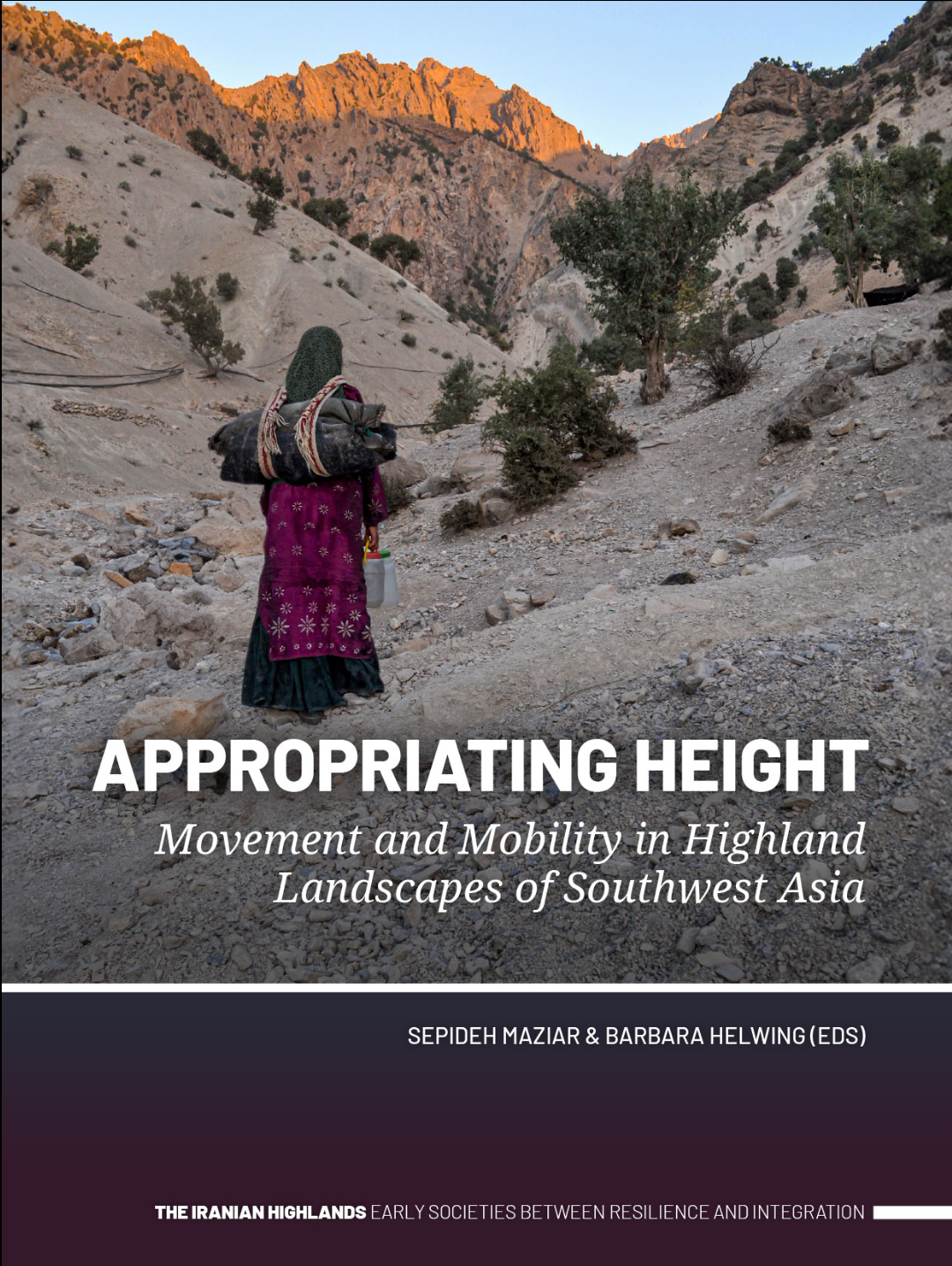 | Maziar, Sepideh; Helwing, Barbara (Ed.): Appropriating Height Movement and Mobility in Highland Landscapes of Southwest Asia. SidestonePress, 2024. (Type: Book | Links | BibTeX)@book{nokey, |
| 2. | 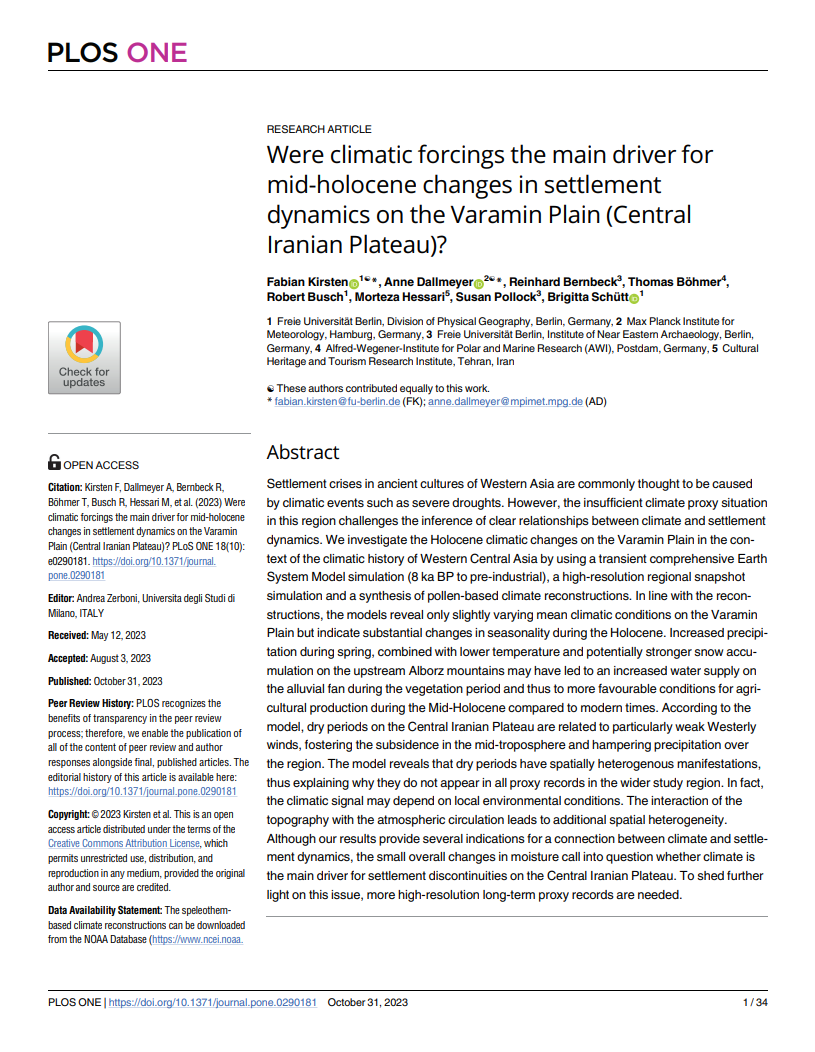 | Kirsten, Fabian; Dallmeyer, Anne; Bernbeck, Reinhard; Böhmer, Thomas; Busch, Robert; Hessari, Morteza; Pollock, Susan; Schütt, Brigitta: Were Climatic Forcings the Main Driver for Mid-Holocene Changes in Settlement Dynamics on the Varamin Plain (Central Iranian Plateau)?. In: PLOS ONE, vol. 18, iss. 10, 2023. (Type: Journal Article | Abstract | Links | BibTeX)@article{nokey,Settlement crises in ancient cultures of Western Asia are commonly thought to be caused by climatic events such as severe droughts. However, the insufficient climate proxy situation in this region challenges the inference of clear relationships between climate and settlement dynamics. We investigate the Holocene climatic changes on the Varamin Plain in the context of the climatic history of Western Central Asia by using a transient comprehensive Earth System Model simulation (8 ka BP to pre-industrial), a high-resolution regional snapshot simulation and a synthesis of pollen-based climate reconstructions. In line with the reconstructions, the models reveal only slightly varying mean climatic conditions on the Varamin Plain but indicate substantial changes in seasonality during the Holocene. Increased precipitation during spring, combined with lower temperature and potentially stronger snow accumulation on the upstream Alborz mountains may have led to an increased water supply on the alluvial fan during the vegetation period and thus to more favourable conditions for agricultural production during the Mid-Holocene compared to modern times. According to the model, dry periods on the Central Iranian Plateau are related to particularly weak Westerly winds, fostering the subsidence in the mid-troposphere and hampering precipitation over the region. The model reveals that dry periods have spatially heterogenous manifestations, thus explaining why they do not appear in all proxy records in the wider study region. In fact, the climatic signal may depend on local environmental conditions. The interaction of the topography with the atmospheric circulation leads to additional spatial heterogeneity. Although our results provide several indications for a connection between climate and settlement dynamics, the small overall changes in moisture call into question whether climate is the main driver for settlement discontinuities on the Central Iranian Plateau. To shed further light on this issue, more high-resolution long-term proxy records are needed. |
| 3. |  | Maziar, Sepideh: Geographical Proximity and Material Culture; The Interplay Between Syunik and the Southern Part of the Araxes River Basin in the 6th to the 3rd Millennium BC. In: Quaternary International, iss. 579, pp. 42-58, 2021. (Type: Journal Article | Abstract | Links | BibTeX)@article{nokey,The region that is known today as Syunik in the south/southeastern part of Armenia is geographically a close neighbour of the southern part of the Araxes river basin in today Iran. Political upheavals and boundaries hindered fieldwork in these areas for many years. The archaeological project of the Araxes valley (APAV) is one of many other projects that launched in 2013 in this region and focused on the southern basin of the Araxes River. The results of the excavations of two sites, Kohne Pasgah Tepesi and Kohne Tepesi, and the intensive survey carried out in this area, enable us to shed more light on the settlement dynamics, material culture and economic/social networks of this area and its neighbours. The period from the 6th up to the middle part of the 4th millennium BC represents the Neolithic and Chalcolithic periods in this region. The material culture of both periods shares many common characteristics with contemporary traditions at sites of the southern Caucasus. Later, in the last part of the 4th millennium BC, a cultural tradition that originated in the southern Caucasus, known as the Kura-Araxes cultural tradition, expanded over a vast area, including the southern part of the Araxes river basin. Based on the study of the pottery styles and obsidian flow, the patterns of interconnection between regions, communities, and sources, and commodity flows are examined. The role of the Araxes River and its tributaries in this interplay over the stated time span is the other inquiry of this article. Furthermore, I will investigate whether spatial propinquity had any impact on commodity flows and exchange, and if so, did this impact affected the material culture and technological practices or not. |
| 4. |  | Maziar, Sepideh; Zalaghi, Ali: Exploring Beyond the River and Inside the Valleys: Settlement Development and Cultural Landscape of the Araxes River Basin Through Time. In: Iran, iss. 59, pp. 36–56, 2020. (Type: Journal Article | Abstract | Links | BibTeX)@article{nokey,Geographical landmarks, especially rivers, have always played an important role in forming or hampering interplay between societies. In some cases, they act as a “communication route” and in some others as “obstacles”. In north-western Iran, it is possible that the Araxes River played such a decisive role by sculpting its surroundings. While our studies are not yet sufficiently adequate to understand the exact role of this river in different time spans, we can begin in some way to conceptualise its role in different periods. The Araxes Valley Archaeological Project (AVAP) was developed with the general aim of investigating settlement development from the fifth to the third millennium BC. Furthermore, studying the possible and probable routes of interaction, both inter- and intra-regional, between the Jolfa and Khoda Afarin plains and the southern Caucasus and north-western Iran, networks of contacts and exchange, and gaining a better understanding of the geographical characteristics of this area and its landscape were among our aims. In this article, the general history of occupation along this river is given to provide a preliminary database to understand the geographical and socio-political potential of this part in order to pursue more comprehensive studies in the future. |
2024 |
|
| Maziar, Sepideh; Helwing, Barbara (Ed.): Appropriating Height Movement and Mobility in Highland Landscapes of Southwest Asia. SidestonePress, 2024. (Type: Book | Links | BibTeX | Tags: Integration, Mobility, Nomadism, Resilience, Settlement mobility)@book{nokey, |
2023 |
|
| Kirsten, Fabian; Dallmeyer, Anne; Bernbeck, Reinhard; Böhmer, Thomas; Busch, Robert; Hessari, Morteza; Pollock, Susan; Schütt, Brigitta: Were Climatic Forcings the Main Driver for Mid-Holocene Changes in Settlement Dynamics on the Varamin Plain (Central Iranian Plateau)?. In: PLOS ONE, vol. 18, iss. 10, 2023. (Type: Journal Article | Abstract | Links | BibTeX | Tags: Climate, Holocene, Settlement mobility)@article{nokey,Settlement crises in ancient cultures of Western Asia are commonly thought to be caused by climatic events such as severe droughts. However, the insufficient climate proxy situation in this region challenges the inference of clear relationships between climate and settlement dynamics. We investigate the Holocene climatic changes on the Varamin Plain in the context of the climatic history of Western Central Asia by using a transient comprehensive Earth System Model simulation (8 ka BP to pre-industrial), a high-resolution regional snapshot simulation and a synthesis of pollen-based climate reconstructions. In line with the reconstructions, the models reveal only slightly varying mean climatic conditions on the Varamin Plain but indicate substantial changes in seasonality during the Holocene. Increased precipitation during spring, combined with lower temperature and potentially stronger snow accumulation on the upstream Alborz mountains may have led to an increased water supply on the alluvial fan during the vegetation period and thus to more favourable conditions for agricultural production during the Mid-Holocene compared to modern times. According to the model, dry periods on the Central Iranian Plateau are related to particularly weak Westerly winds, fostering the subsidence in the mid-troposphere and hampering precipitation over the region. The model reveals that dry periods have spatially heterogenous manifestations, thus explaining why they do not appear in all proxy records in the wider study region. In fact, the climatic signal may depend on local environmental conditions. The interaction of the topography with the atmospheric circulation leads to additional spatial heterogeneity. Although our results provide several indications for a connection between climate and settlement dynamics, the small overall changes in moisture call into question whether climate is the main driver for settlement discontinuities on the Central Iranian Plateau. To shed further light on this issue, more high-resolution long-term proxy records are needed. |
2021 |
|
| Maziar, Sepideh: Geographical Proximity and Material Culture; The Interplay Between Syunik and the Southern Part of the Araxes River Basin in the 6th to the 3rd Millennium BC. In: Quaternary International, iss. 579, pp. 42-58, 2021. (Type: Journal Article | Abstract | Links | BibTeX | Tags: Bronze Age, Chalcolithic, Economy, Kura-Araxes, Neolithic, Settlement mobility, Social, social relations, Survey)@article{nokey,The region that is known today as Syunik in the south/southeastern part of Armenia is geographically a close neighbour of the southern part of the Araxes river basin in today Iran. Political upheavals and boundaries hindered fieldwork in these areas for many years. The archaeological project of the Araxes valley (APAV) is one of many other projects that launched in 2013 in this region and focused on the southern basin of the Araxes River. The results of the excavations of two sites, Kohne Pasgah Tepesi and Kohne Tepesi, and the intensive survey carried out in this area, enable us to shed more light on the settlement dynamics, material culture and economic/social networks of this area and its neighbours. The period from the 6th up to the middle part of the 4th millennium BC represents the Neolithic and Chalcolithic periods in this region. The material culture of both periods shares many common characteristics with contemporary traditions at sites of the southern Caucasus. Later, in the last part of the 4th millennium BC, a cultural tradition that originated in the southern Caucasus, known as the Kura-Araxes cultural tradition, expanded over a vast area, including the southern part of the Araxes river basin. Based on the study of the pottery styles and obsidian flow, the patterns of interconnection between regions, communities, and sources, and commodity flows are examined. The role of the Araxes River and its tributaries in this interplay over the stated time span is the other inquiry of this article. Furthermore, I will investigate whether spatial propinquity had any impact on commodity flows and exchange, and if so, did this impact affected the material culture and technological practices or not. |
2020 |
|
| Maziar, Sepideh; Zalaghi, Ali: Exploring Beyond the River and Inside the Valleys: Settlement Development and Cultural Landscape of the Araxes River Basin Through Time. In: Iran, iss. 59, pp. 36–56, 2020. (Type: Journal Article | Abstract | Links | BibTeX | Tags: Armenia, Azerbaijan, Bronze Age, Caucasus, Chalcolithic, Georgia, Iron Age, Kura-Araxes, Landscape, Mobility, Neolithic, Settlement and subsistance systems, Settlement mobility, Settlement structure, Structure development)@article{nokey,Geographical landmarks, especially rivers, have always played an important role in forming or hampering interplay between societies. In some cases, they act as a “communication route” and in some others as “obstacles”. In north-western Iran, it is possible that the Araxes River played such a decisive role by sculpting its surroundings. While our studies are not yet sufficiently adequate to understand the exact role of this river in different time spans, we can begin in some way to conceptualise its role in different periods. The Araxes Valley Archaeological Project (AVAP) was developed with the general aim of investigating settlement development from the fifth to the third millennium BC. Furthermore, studying the possible and probable routes of interaction, both inter- and intra-regional, between the Jolfa and Khoda Afarin plains and the southern Caucasus and north-western Iran, networks of contacts and exchange, and gaining a better understanding of the geographical characteristics of this area and its landscape were among our aims. In this article, the general history of occupation along this river is given to provide a preliminary database to understand the geographical and socio-political potential of this part in order to pursue more comprehensive studies in the future. |